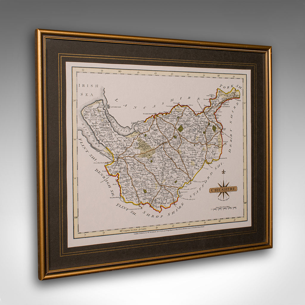


Vintage County Map of Cheshire, English, After John Cary, Cartography Interest
Our Stock # 25577
This is a vintage Cheshire map, a fine reproduction of John Cary’s late 18th century cartography, and presented within a smart glazed frame.
- Superb county map of Cheshire, offering fine cartographic interest
- Faithful reproduction of the original work by John Cary, circa September 1787
- Attractive hand coloured palette, highlighting boundaries and topographic detail
- Fascinating detail throughout, with period place names and transport routes
- Displays a desirable aged patina, adding character and charm
- Set within a quality glazed frame, both protective and presentational
- Dressed to the rear with a hanging loop, for immediate wall display
- Delivered ready to enjoy, ideal for study, hallway, or traditional décor themes
A tasteful and informative addition to any interior, this vintage framed map of Cheshire captures the essence of historic English cartography, and makes a superb gift or collector’s piece. Delivered ready to display.
Dimensions:
Max Width: 35cm (13.75'')
Max Depth: 1cm (.5'')
Max Height: 30cm (11.75'')
Map Width: 27.5cm (10.75'')
Map Height: 22.5cm (8.75'')
Share this Product
Delivery
We ship to the U.K. and internationally every week. We hand deliver most of our U.K. orders. Deliveries take approximately ten to fifteen working days to arrive at your door from receipt of order.
Internationally, our price includes our specialist packing service and all pre-shipment paperwork. We ship with all the major carriers; FedEx, UPS, DHL etc and shipments are fully tracked and insured. Deliveries take approximately ten to fifteen working days to arrive at your door from receipt of order.
|
UK Mainland
|
loading.. |
|
Europe
|
loading.. |
|
USA & Canada |
loading.. |
|
Rest of the World
|
loading.. |
|
Russia
|
- |